
Photo: mrlins derivative work: Jjtkk · CC BY 2.0 · via Wikimedia Commons, shown in greyscale
Tuvalu places highest on Adult Literacy Rate (top 1% worldwide) and lowest on Progress Toward Productive and Sustainable Agriculture (SDG 2.4.1 Proxy) (bottom 1%).
Share
Tuvalu in the Nations Inquiry Country Index
Tuvalu appears in 164 of the statistics tracked here, but is not placed in the Country Index: the index needs a standing on three quarters of its topics, and Tuvalu is measured on too few of them. Every published reading below is unaffected.
At a glance
Population
9,816
people
since 1950
Land area
26
km²
since 1961
GDP per person
5,776
international $, PPP
since 1990
Life expectancy
67.1
years at birth
since 1950
Human development
0.689
HDI, 0–1
since 1990
The newest published figure for each, the year it describes and who published it, with a line showing how it has moved.
01The country
About Tuvalu
Tuvalu’s nine reef islands and atolls lie across the western Pacific, none rising far above the high-tide mark, and form an independent constitutional monarchy within the Commonwealth. The name means ‘eight standing together’. Funafuti, the main atoll, is a thin necklace of islets around a broad lagoon, and its airstrip doubles as a football pitch when no plane is due. Islanders dig pits through the coral to raise pulaka, a giant swamp taro, and king tides seep up through the ground itself.
Polynesian settlers came mostly from Samoa and Tonga, though Nui’s people speak a language close to that of Kiribati. The Spanish navigator Álvaro de Mendaña saw Nui in 1568. In 1861 a drifting canoe brought Elekana, a Cook Islands deacon, to Nukulaelae, and Samoan pastors spread Christianity from there; in 1863 Peruvian slavers carried off many islanders. Britain joined the islands, then the Ellice Islands, to the Gilberts in 1892; they separated in 1975 and became independent as Tuvalu in October 1978.
Each island keeps its falekaupule, a council of elders meeting in the maneapa, the open-sided community hall, where fatele dances build from slow chant to fast, pounding song. Te ano, a team game played with a pandanus ball, survives beside football, and the Church of Tuvalu draws most islanders on Sunday. Tuna fishing licences, a trust fund set up with donors in 1987, stamps and the wages of seafarers trained on Amatuku for foreign merchant ships keep the state going.
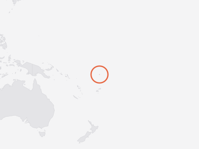
Key facts about Tuvalu
- Capital
- Funafuti
- Official languages
- English, Tuvaluan
- Currencies
- Tuvaluan dollar, Australian dollar (AUD)
- ISO code
- TUV · TV
- Domain · dialling
- .tv · +688
As Wikidata records them. Official languages are the least consistent — some countries list only a national language, others every regional one. Sources and licences.
02Country Index 2026
Where it stands, topic by topic
Strongest first. Each position is Tuvalu’s place among the countries with a standing on that topic, built from a few key statistics chosen to measure different things.
19thof 198
From 2 of 4 key statistics
30thof 198
From 4 of 4 key statistics
77thof 193
From 3 of 4 key statistics
106thof 200
From 3 of 4 key statistics
155thof 196
From 3 of 3 key statistics
172ndof 194
From 2 of 4 key statistics
191stof 198
From 3 of 4 key statistics
No standing — Tuvalu holds too few of this subject’s key statistics to be placed on it.
No standing — Tuvalu holds too few of this subject’s key statistics to be placed on it.
No standing — Tuvalu holds too few of this subject’s key statistics to be placed on it.
No standing — Tuvalu holds too few of this subject’s key statistics to be placed on it.
No standing — Tuvalu holds too few of this subject’s key statistics to be placed on it.
No standing — Tuvalu holds too few of this subject’s key statistics to be placed on it.
No standing — Tuvalu holds too few of this subject’s key statistics to be placed on it.
No standing — Tuvalu holds too few of this subject’s key statistics to be placed on it.
No standing — Tuvalu holds too few of this subject’s key statistics to be placed on it.
Each standing is built from a few key statistics chosen to measure different things. Select a subject for Tuvalu’s readings on it, or see every statistic held for Tuvalu in the table further down this page.
03Highs and lows
Where Tuvalu stands out
The two ends of its own record: every statistic on which Tuvalu sits within ten places of the best or worst in the world, plus its strongest and weakest readings overall. Each is turned into a percentile — its place among every country measured — which is what lets a hunger score and a press-freedom rank be compared at all.
Where Tuvalu does best7
In the top third of all countries measured. 5 are within ten places of the best in the world, in a field of at least 50 countries — marked with that place.
- 1st
- 1stDeaths in Organized Violencetop 35%
Position · derived 59th of 59 · 1 = worst · 0 · 2025
world median 0
- 2nd
Position · derived 2nd of 123 · 12.85 · 2023
world median 3.709 (better)
- 9th
Position · derived 9th of 211 · 1.422 · 2025
world median 0.171 (better)
- 10thChild Marriagetop 8%
Position · derived 134th of 143 · 1 = worst · 1.8 · 2025
world median 17.1 (better)
Not ranked by the publisher · 99 · 2025
world median 91 (better) · ▲ 29 pts since 2015
Where Tuvalu struggles most5
In the bottom third of all countries measured. 2 are within ten places of the worst in the world, in a field of at least 50 countries — marked with that place.
- 1st
Position · derived 186th of 186 · 1.67 · 2024
world median 3.14 (worse)
- 10thGovTech Maturity Indexbottom 5%
Position · derived 187th of 196 · 0.124 · 2025
world median 0.63 (worse) · ▲ 2 pts since 2022
- Child and Family Benefit Coveragebottom 2%
Not ranked by the publisher · 0 · 2024
world median 23.75 (worse)
Not ranked by the publisher · 0.97 · 2025
world median 18.18 (worse)
- Social Protection Coveragebottom 5%
Not ranked by the publisher · 4.5 · 2025
world median 52.1 (worse)
A band is a place among the countries each publisher scores, so Tuvalu can move because other countries moved. See the Country Index for the full method.
04Over time
Which way it is moving
The published rank in widely quoted reports, edition by edition — each end with the size of that year’s field.
Human Development Index
UNDP Human Development Report Office
95th
of 141 · 1990
129th
of 193 · 2023
Ranked in 34 of 34 editions
05In context
Tuvalu and its neighbours
A position reads best beside the countries around it. Every position below is a place in the world ranking, not within the region.
Shares a land border with
Tuvalu has no land border with another country.
Across Polynesia
Every country in the sub-region, by its position in the world.
- 89
 Samoa
- =97
 Tonga
- —
 American Samoanot placed
- —
 Cook Islandsnot placed
- —
 French Polynesianot placed
- —
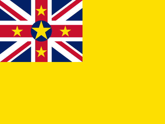 Niuenot placed
- —
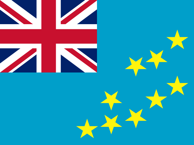 Tuvalunot placed
06The evidence
Every statistic we hold for Tuvalu
Grouped by topic. Each row gives the newest edition’s rank or position, the published value and the year the numbers describe. Select a statistic for this country’s row beside every other country, the world median and every edition.
Governance & Institutions19
- Central Bank Independence IndexAna Carolina Garriga, University of Essex · CBI index (0–1, where 1 is the most statutory independence)bottom 1%0.0062023
- Child and Family Benefit CoverageILO · Children or households with children receiving child or family cash benefits (%)bottom 2%02024
- Civic Space RatingsCIVICUS · Civic space score (0–100)22nd of 198position · derived87.622025
- Climate Readiness (ND-GAIN)Notre Dame Global Adaptation Initiative (ND-GAIN), University of Notre Dame · ND-GAIN Readiness (0–1, where 1 is the most ready)71st of 192rank0.452024
- Completeness of Birth RegistrationUNICEF · Children under 5 whose birth is registered (%)bottom 28%87.22025
- Control of CorruptionWorld Bank Group · Control of Corruption (−2.5 to 2.5)63rd of 211position · derived0.5832025
- Country Policy and Institutional AssessmentWorld Bank Group · IDA Resource Allocation Index (1 = low to 6 = high)60th of 78position · derived2.8582025
- Disability Benefit CoverageILO · People with severe disabilities receiving disability benefits (%)bottom 49%42.32025
- Government AI Readiness IndexOxford Insights · AI readiness score (0–100)169th of 195rank20.872025
- Government EffectivenessWorld Bank Group · Governance estimate (−2.5 weak to 2.5 strong)154th of 209position · derived-0.6032025
- Government Spending on EducationUIS · Government expenditure on education (% of GDP)2nd of 123position · derived12.852023
- GovTech Maturity IndexWorld Bank Group · GTMI score (0–1)187th of 196position · derived0.1242025
- Old-Age Pension CoverageILO · People above statutory pensionable age receiving an old-age pension (%)top 15%1002025
- Public Sector Wage BillWorld Bank Group · Public sector wage bill (% of GDP)2nd of 168position · derived31.312022
- Regulatory QualityWorld Bank Group · Regulatory Quality (−2.5 to 2.5)133rd of 209position · derived-0.4422025
- Rule of LawWorld Bank Group · Rule of Law estimate (−2.5 to 2.5)24th of 211position · derived1.3532025
- Statistical Performance IndicatorsWorld Bank Group · SPI overall score (0–100)174th of 188position · derived43.022024
- Voice and AccountabilityWorld Bank Group · Voice and Accountability estimate (−2.5 to 2.5)21st of 206position · derived1.2582025
Economy & Innovation15
- Commodity Export DependenceUNCTAD · Commodity exports (% of merchandise exports, three-year average)bottom 48%65.862024
- Crop Production IndexFAO · Crop production index (2014–2016 = 100)67th of 195position · derived112.682022
- Digitally-Deliverable Services ExportsUNCTAD · Digitally-deliverable services exports (% of services exports)160th of 170position · derived3.6192024
- Export Concentration IndexUNCTAD · Export concentration index (0–1, normalised Herfindahl–Hirschman)top 8%0.682025
- Food Production IndexFAO · Food production index (2014–2016 = 100)81st of 195position · derived110.822022
- Foreign Direct Investment InflowsUNCTAD · FDI inflows (% of GDP)bottom 15%0.4052025
- GDP GrowthWorld Bank Group · GDP growth (annual %)144th of 186position · derived1.6392025
- GDP per Capita (PPP)World Bank Group · GDP per capita (constant 2021 international $, PPP)143rd of 185position · derived5,7762025
- Inflation, GDP DeflatorWorld Bank Group · Annual change in the GDP implicit deflator (%)bottom 26%1.8192025
- Livestock Production IndexFAO · Livestock production index (2014–2016 = 100)101st of 194position · derived106.492022
- Merchant Fleet by Country of OwnershipUNCTAD · Merchant fleet owned (thousand dead-weight tons)bottom 8%1.032026
- Productive Capacities IndexUNCTAD · Productive Capacities Index (1–100)64th of 195position · derived52.732022
- Scholarly ArticlesOurResearch · Articles with at least one author at an institution in the country (full counting)bottom 3%82025
- Services ExportsUNCTAD · Services exports (% of GDP)top 27%20.222025
- Total Natural Resources Rents (% of GDP)World Bank Group · Natural resources rents (% of GDP)180th of 180position · derived02021
Work & Labour3
- Compliance with Labour RightsILO · Compliance with freedom of association and collective bargaining rights (0 = best, 10 = worst)top 43%1.422024
- Informal Employment RateILO · Informal employment (% of total employment)61st of 97position · derived · 1 = worst18.752025
- Unemployment Benefit CoverageILO · Unemployed people receiving unemployment benefits (%)bottom 26%02024
Education & Knowledge22
- Adult Literacy RateUIS · Adults 15+ who can read and write (%)1st of 172position · derived1002024
- Expected Years of SchoolingUNDP Human Development Report Office · Expected years of schooling132nd of 195position · derived12.382023
- Harmonized Test ScoresWorld Bank Group · Harmonized test score (TIMSS-equivalent points; 300 = minimum, 625 = advanced attainment)155th of 172position · derived346.52020
- Intergenerational Persistence in EducationWorld Bank Group · Correlation between own and parents' years of schooling, born 1980–89 (0–1)85th of 153position · derived · 1 = worst0.4342017
- Learning-Adjusted Years of SchoolWorld Bank Group · Learning-adjusted years of school (0–14)129th of 172position · derived5.9982020
- Lower Secondary Completion RateUIS · Lower secondary completion rate (%)89th of 164position · derived84.822025
- Mean Years of SchoolingUNDP Human Development Report Office · Mean years of schooling (adults 25+)79th of 193position · derived10.772023
- Minimum Proficiency in Mathematics, End of PrimaryUIS · Pupils at the end of primary reaching minimum proficiency in mathematics (%)top 41%54.672023
- Minimum Proficiency in Reading, End of PrimaryUIS · Pupils at the end of primary reaching minimum proficiency in reading (%)bottom 26%32.092023
- Out-of-School Rate, Lower Secondary AgeUIS · Out-of-school rate, lower secondary age (%)39th of 116position · derived · 1 = worst12.212024
- Out-of-School Rate, PrimaryUIS · Out-of-school rate, primary age (%)105th of 121position · derived · 1 = worst0.5372024
- Participation in Organised Learning One Year Before PrimaryUIS · Children one year before primary entry age in organised learning (%)30th of 112position · derived94.942024
- Pre-Primary Net Enrolment RateUIS · Net enrolment rate, pre-primary (%)47th of 120position · derived74.432024
- Primary Completion RateUIS · Primary completion rate (%)67th of 165position · derived98.772025
- Primary Schools with ElectricityUIS · Primary schools with access to electricity (%)top 30%1002024
- Primary Schools with Internet for TeachingUIS · Primary schools with internet access for teaching (%)bottom 42%902024
- Pupils per Qualified Teacher, PrimaryUIS · Primary pupils per qualified teacher (headcount basis)51st of 92position · derived · 1 = worst19.882024
- Qualified Teachers in Primary EducationUIS · Primary teachers with the minimum qualifications their country requires (%)bottom 10%60.22024
- Secondary School EnrolmentUIS · Gross secondary enrolment ratio (%)66th of 109position · derived90.662024
- Upper Secondary Completion RateUIS · Upper secondary completion rate (%)91st of 164position · derived57.422025
- Wealth Parity Index, Lower Secondary CompletionUIS · Adjusted wealth parity index, lower secondary completion (poorest vs richest fifth; 1 = parity)top 30%0.8172024
- Youth Literacy RateUIS · 15–24 year-olds who can read and write (%)top 3%1002024
Health & Wellbeing41
- Adolescent Birth Rate (Ages 15–19)UN DESA Population Division · Live births per 1,000 women aged 15–19111th of 222position · derived · 1 = worst27.512023
- Adult Mortality (Probability of Dying Between 15 and 60)UN DESA Population Division · Deaths before age 60 per 1,000 people alive at 15, at that year's death rates17th of 222position · derived · 1 = worst255.222023
- Antenatal Care Coverage, At Least Four VisitsUNICEF · Women with a live birth who had 4+ antenatal visits (%)121st of 153position · derived60.32025
- Caesarean Section RateUNICEF · Live births delivered by caesarean section (%)bottom 49%20.22025
- Children with Functional DifficultiesUNICEF · Children aged 5-17 with a functional difficulty (%)bottom 48%12.82024
- Contraceptive Prevalence (Any Method)UN DESA Population Division · Share of all women aged 15–49 using any contraceptive method (%)bottom 11%19.62023
- Days Above 35°CECMWF · Days a year with a maximum temperature above 35°C, averaged over the country’s landtop 16%02025
- Demand for Family Planning Satisfied by Modern MethodsUN DESA Population Division · Share of women aged 15–49 wanting to avoid pregnancy who use a modern method (%)169th of 196position · derived45.32023
- Early Initiation of BreastfeedingUNICEF · Newborns put to the breast within one hour of birth (%)107th of 136position · derived39.152024
- Exclusive Breastfeeding Under Six MonthsUNICEF · Infants under 6 months exclusively breastfed (%)60th of 136position · derived43.82024
- Fish and Seafood Supply per PersonFAO · Fish and seafood available as food (kg per person per year, live-weight equivalent)top 3%55.922023
- Fruit Supply per PersonFAO · Fruit available as food, excluding wine (kg per person per year)top 28%111.932023
- Global Multidimensional Poverty IndexOPHI · MPI (0–1)81st of 109position · derived · 1 = worst0.0082025
- HPV Vaccination Coverage, GirlsWUENIC · Girls in the target group given the final dose of HPV vaccine (%)top 29%782025
- Human Capital IndexWorld Bank Group · HCI score (0–1)128th of 172position · derived0.4482020
- Human Development IndexUNDP Human Development Report Office · HDI score (0–1)129th of 193rank0.6892023
- Immunisation Coverage, DTP3WUENIC · Infants given a third dose of DTP vaccine (%)top 5%992025
- Immunisation Coverage, Measles First Dose (MCV1)WUENIC · Infants given a first dose of measles vaccine (%)top 19%972025
- Infant Mortality RateUN IGME · Deaths before age one (per 1,000 live births)77th of 200position · derived · 1 = worst16.52024
- Institutional DeliveriesUNICEF · Live births delivered in a health facility (%)top 38%98.52025
- Life Expectancy at Age 65UN DESA Population Division · Further years a 65-year-old would live at current death rates187th of 222position · derived13.592023
- Life Expectancy at BirthUN DESA Population Division · Years a newborn would live at current death rates179th of 222position · derived67.12023
- Maternal Mortality RatioMMEIG · Maternal deaths per 100,000 live births46th of 195position · derived · 1 = worst169.712023
- Meat Supply per PersonFAO · Meat available as food (kg per person per year, carcass weight)top 17%85.222023
- Minimum Dietary Diversity, Children Aged 6–23 MonthsUNICEF · Children aged 6-23 months fed from at least 5 of 8 food groups (%)66th of 115position · derived29.292025
- Modern Contraceptive PrevalenceUN DESA Population Division · Share of all women aged 15–49 using a modern contraceptive method (%)bottom 14%17.62023
- Mortality Rate, Ages 5–14UN IGME · Deaths between ages 5 and 14 (per 1,000 children aged 5)73rd of 200position · derived · 1 = worst4.192024
- Neonatal Mortality RateUN IGME · Deaths in the first 28 days (per 1,000 live births)96th of 200position · derived · 1 = worst8.6922024
- Oral Rehydration Salts for Children with DiarrhoeaUNICEF · Children under 5 with diarrhoea given oral rehydration salts (%)53rd of 127position · derived45.72024
- Overweight Prevalence in Children Under FiveUNICEF, WHO and World Bank Group (Joint Malnutrition Estimates) · Children under 5 who are overweight (%)118th of 163position · derived · 1 = worst4.0732024
- Pesticide Use per HectareFAO · Pesticide use (kg per hectare of cropland)127th of 178position · derived0.842024
- PM2.5 Air Pollution ExposureAtmospheric Composition Analysis Group, Washington University in St. Louis · Population-weighted PM2.5 concentration (µg/m³)205th of 220position · derived · 1 = worst4.42023
- Postnatal Care for Newborns Within Two DaysUNICEF · Newborns with a health check within 2 days of birth (%)21st of 109position · derived96.52025
- Severe Child Food Poverty, Children Aged 6–23 MonthsUNICEF · Children aged 6-23 months fed from at most 2 of 8 food groups (%)70th of 113position · derived · 1 = worst13.992024
- Stillbirth RateUN IGME · Stillbirths (per 1,000 total births)92nd of 200position · derived · 1 = worst8.7092023
- Stunting Prevalence in Children Under FiveUNICEF, WHO and World Bank Group (Joint Malnutrition Estimates) · Children under 5 who are stunted (%)132nd of 162position · derived · 1 = worst5.6762024
- Under-Five Mortality RateUN IGME · Deaths before age five (per 1,000 live births)76th of 200position · derived · 1 = worst19.172024
- Vegetable Supply per PersonFAO · Vegetables available as food (kg per person per year)bottom 38%72.422023
- Violent Discipline of ChildrenUNICEF · Children aged 1-14 experiencing violent discipline (%)39th of 90position · derived · 1 = worst79.72025
- Wasting Prevalence in Children Under FiveUNICEF, WHO and World Bank Group (Joint Malnutrition Estimates) · Children under 5 who are wasted (%)104th of 163position · derived · 1 = worst2.7662024
Development & Human Capital9
- Access to ElectricityWorld Bank Group · Population with electricity access (%)top 28%1002024
- Access to Electricity, RuralWorld Bank Group · Rural population with electricity access (%)top 29%1002024
- Child MarriageUNICEF · Women 20–24 married before 18 (%)134th of 143position · derived · 1 = worst1.82025
- Coefficient of Human InequalityUNDP Human Development Report Office · Coefficient of Human Inequality (%)96th of 169position · derived · 1 = worst15.822023
- Gender Development IndexUNDP Human Development Report Office · Gender Development Index (1.000 = parity)92nd of 184position · derived0.9692023
- Inequality-adjusted Human Development IndexUNDP Human Development Report Office · IHDI (0–1)99th of 169position · derived0.5782023
- Multidimensional Poverty MeasureWorld Bank Group · Multidimensional poverty headcount ratio (%)61st of 157position · derived · 1 = worst9.6432025
- Net Official Development Assistance ReceivedOECD Development Assistance Committee · Net ODA received (% of GNI)1st of 130position · derived101.782023
- Poverty Headcount at $3.00 a Day, Line-up EstimatesWorld Bank Group · Population below $3.00 a day, 2021 PPP, World Bank line-up estimate (%)top 45%1.332024
Environment & Sustainability22
- Agricultural EmissionsFAO · Farm-gate emissions (kt CO₂eq)187th of 193position · derived7.9042023
- Agricultural Emissions IntensityFAO · Greenhouse gases from farming per value of agricultural output (kg CO₂eq per international dollar)18th of 190position · derived · 1 = worst5.132023
- Agricultural LandFAO · Agricultural land (% of land area)40th of 209position · derived602023
- Annual Forest Area Change RateFAO · Compound annual change in forest area over the interval ending that year (%)top 49%02025
- Burned AreaGWIS · Burned area (hectares)bottom 12%02025
- Climate Vulnerability (ND-GAIN)Notre Dame Global Adaptation Initiative (ND-GAIN), University of Notre Dame · ND-GAIN Vulnerability (0–1, where 1 is the most vulnerable)170th of 190rank0.5732024
- CO₂ Emissions per CapitaGlobal Carbon Project · Fossil CO₂ (tonnes per person)149th of 210position · derived · 1 = worst1.1862024
- Cropland Nitrogen BalanceFAO · Nitrogen surplus (+) or deficit (−) on cropland, kg per hectaretop 44%42.952023
- Fisheries and Aquaculture ProductionFAO · Fish, crustaceans, molluscs and other aquatic animals caught or farmed, tonnes (live weight)bottom 48%45,4422024
- Forest AreaFAO · Forest area (% of land area)99th of 210position · derived33.332023
- Forest Area within Legally Established Protected AreasFAO · Forest within legally established protected areas, as a share of the country's 2015 forest area (%)bottom 4%0.972025
- Livestock DensityFAO · Livestock units per hectare of agricultural land21st of 188position · derived1.962023
- Mangrove AreaGlobal Mangrove Watch (Aberystwyth University, JAXA, soloEO, Wetlands International, The Nature Conservancy) · Mangrove forest area (hectares)bottom 14%37.842025
- Methane EmissionsEDGAR · Methane emissions (gigagrams of CH₄)bottom 2%0.1582025
- Municipal Solid Waste GenerationWorld Bank Group · Municipal solid waste generated (kg per person per day)171st of 201position · derived · 1 = worst0.4222026
- ND-GAIN Country IndexNotre Dame Global Adaptation Initiative (ND-GAIN), University of Notre Dame · ND-GAIN Index (0–100, where 100 is best placed to adapt)117th of 190rank43.862024
- Population Living Below 5 m ElevationCenter for International Earth Science Information Network (CIESIN), Columbia University · Population living below 5 m elevation (% of total population)top 3%39.272015
- Progress Toward Productive and Sustainable Agriculture (SDG 2.4.1 Proxy)FAO · Current status score, from 1 (worst) to 5 (best), averaged over up to seven sub-indicators186th of 186position · derived1.672024
- Solar Electricity Installed CapacityEIA · Solar generating capacity installed (gigawatts)bottom 16%0.0052024
- Temperature Change on LandFAO · Change in mean land-surface temperature against the country's own 1951–1980 average, °Cbottom 6%0.8362025
- Tree Cover LossWorld Resources Institute — Global Forest Watch (data: University of Maryland) · Tree cover loss (hectares, where canopy cover exceeded 30% in 2000)bottom 6%02025
- World Risk IndexInstitute for International Law of Peace and Armed Conflict (IFHV), Ruhr University Bochum · WorldRiskIndex score (0–100, where 100 is the most at risk)164th of 193position · derived · 1 = worst1.472025
Gender & Equality4
- Female-Headed HouseholdsUN DESA Population Division · Households headed by a woman (% of households)bottom 17%18.042026
- Mean Age at First Marriage, WomenUN DESA Population Division · Singulate mean age at marriage, women (years)bottom 17%21.52019
- Sex Ratio at BirthUN DESA Population Division · Male births per 100 female birthstop 12%1072023
- Women Who Think a Husband Is Justified in Hitting or Beating His WifeUNICEF · Women aged 15-49 who say a husband is justified in hitting or beating his wife (%)30th of 125position · derived · 1 = worst43.12025
Peace & Security7
- Civilian Deaths in Organized ViolenceUCDP · Civilians killed in organized violence (people)top 37%02025
- Deaths in Non-State ConflictUCDP · Deaths in non-state conflict (people)top 43%02025
- Deaths in Organized ViolenceUCDP · Deaths in organized violence (people)59th of 59position · derived · 1 = worst02025
- Deaths in State-Based Armed ConflictUCDP · Deaths in state-based armed conflict (people)top 39%02025
- INFORM Risk IndexEuropean Commission Joint Research Centre, with the Inter-Agency Standing Committee · INFORM Risk score (0–10, where 10 is the highest risk)148th of 191position · derived · 1 = worst2.52025
- Political Stability and Absence of ViolenceWorld Bank Group · Political Stability estimate (−2.5 to 2.5)9th of 211position · derived1.4222025
- Refugees by Country of OriginUNHCR, the UN Refugee Agency · Refugees under UNHCR's mandate from this country, end of year (people)bottom 2%02025
Mobility & Trade4
- EmigrantsUN DESA Population Division · Migrants from the country living abroad, mid-year (people)bottom 4%1,2392024
- International MigrantsUN DESA Population Division · International migrants living in the country, mid-year (people)bottom 1%2462024
- Net Migration RateUN DESA Population Division · Net migrants per 1,000 populationbottom 1%-32.912023
Poverty & Inequality1
- Poverty Headcount at National Poverty LinesWorld Bank Group · Population below the national poverty line (%)top 38%26.32025
Energy2
- Natural Gas ProductionEIA · Dry natural gas produced (billion cubic metres)bottom 27%02024
- Photovoltaic Power Potential (PVOUT)World Bank Group (ESMAP), data by Solargis · Practical solar power potential (kWh per kWp per day, long-term average)bottom 49%4.2672020
People & Population15
- Average Household SizeUN DESA Population Division · Average number of usual residents per household (people)top 7%6.052026
- Crude Birth RateUN DESA Population Division · Births per 1,000 populationtop 26%23.072023
- Crude Death RateUN DESA Population Division · Deaths per 1,000 populationtop 29%9.1382023
- Mean Age at ChildbearingUN DESA Population Division · Mean age of mothers at the birth of their children (years)top 45%29.192023
- Median Age of the PopulationUN DESA Population Division · Median age (years)bottom 30%24.292023
- One-Person HouseholdsUN DESA Population Division · Households with exactly one member (% of households)bottom 24%6.922026
- Population Aged 65 and OverUN DESA Population Division · Share of the total population aged 65 and over (%)bottom 38%6.2762023
- Population DensityUN DESA Population Division · People per square kilometre of landtop 16%327.182023
- Population Growth RateUN DESA Population Division · Population growth (% per year)bottom 3%-1.8032023
- Population Living in Cities (Degree of Urbanisation)UN DESA Population Division · Share of the population living in cities as the Degree of Urbanisation defines them (%)bottom 8%02025
- Population Under Age 15UN DESA Population Division · Share of the total population aged 0–14 (%)top 27%32.62023
- Sex Ratio of the Total PopulationUN DESA Population Division · Males per 100 femalestop 10%104.722023
- Total Dependency RatioUN DESA Population Division · People aged 0–14 and 65+ per 100 people aged 15–64top 27%63.62023
- Total Fertility RateUN DESA Population Division · Live births per womantop 23%3.2082023
07Method
Sources and how to read them
How to read this page
- The scores and ranks belong to their publishers. Nothing is adjusted, rescaled or re-ranked; each is reproduced from the edition named beside it. Where a row says position · derived, the publisher ranks nobody on that measure and the position is ours, made by ordering the published score.
- Each statistic shows its newest edition, which is not always the edition the Country Index uses: the index pins every source to one data year so its average compares like with like.
How a standing is built from percentiles, why Tuvalu can move because other countries moved, and why publishers measure between 120 and 215 countries each are set out in full in how a standing is made and what a standing cannot tell you.
Sources
- Statistics: 33 publishers, each named beside its numbers, with every edition and licence on the datasets pages.
- Capital, languages, currency, codes: Wikidata, public domain (CC0).
- Map and land borders: Natural Earth, public domain. Borders are de facto — where administration actually changes — not claimed.
Photographs
The photograph of Tuvalu on this page comes from Wikimedia Commons and is shown in greyscale. The photographer and the licence are named beside each one.
Cite this page
Nations Inquiry (2026). Tuvalu: country statistics, rankings and trends. https://nationsinquiry.com/countries/tuvalu