Data for 2021
Burned Area, 2021
2021, as GWIS’s 2026 release gives it · stored as published, never rewritten
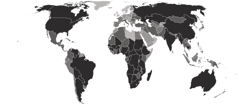
This is how much land burned in a year — forest, savanna, grassland and farmland — as seen from NASA's MODIS satellites and added up per country by the European Commission's Global Wildfire Information System. It counts wildfires and every other vegetation fire, including fires set to clear fields.
Burned Area, 2021 covers 209 countries on 6 measures. Angola is highest, at 34,489,337.85; 59 countries share the lowest reading, 0.00. The middle country reads 9,359.12. Against 2020, 160 values changed (63 up, 97 down), the same countries are covered.
Burned Area · Data for 2021
HighestAngola
34,489,337.85Lowest59 countries share it
0.00Shaded by value in five groups of equal size, darkest at the highest end.
01Values only
The table
Every country and every column of Burned Area, 2021, as published. The file carries values only, so no position is shown. “=” marks a shared position.
Showing 25 of 209 countries · select a heading to sort
AngolaAGOMiddle Africa | 34,489,337.85 | 2,084,443.050 | 20,810,514.406 | 11,425,229.359 | 163,333.782 | 5,817.250 |
 DR Congo CODMiddle Africa | 33,362,272.50 | 4,382,085.093 | 27,573,271.519 | 1,343,677.436 | 21,487.335 | 41,751.118 |
 South Sudan SSDEastern Africa | 28,143,426.41 | 361,141.753 | 16,231,200.925 | 10,707,196.091 | 835,236.899 | 8,650.745 |
 Australia AUSAustralia and New Zealand | 26,610,248.29 | 65,535.296 | 3,019,732.351 | 22,986,359.107 | 526,858.244 | 11,763.294 |
 Zambia ZMBEastern Africa | 20,345,692.52 | 2,902,120.869 | 13,335,133.439 | 4,031,697.738 | 51,217.560 | 25,522.918 |
 Mozambique MOZEastern Africa | 18,182,040.44 | 3,251,649.591 | 12,195,896.930 | 2,680,593.117 | 47,611.298 | 6,289.503 |
 Central African Republic CAFMiddle Africa | 16,682,005.61 | 3,316,841.421 | 10,816,414.427 | 2,444,060.727 | 102,628.312 | 2,060.726 |
 Brazil BRASouth America | 15,723,619.07 | 1,645,251.412 | 7,663,293.183 | 4,839,157.813 | 1,412,861.934 | 163,054.731 |
 Russia RUSEastern Europe | 12,612,506.53 | 574,877.404 | 9,143,686.727 | 2,002,057.059 | 873,081.234 | 18,804.103 |
 Botswana BWASouthern Africa | 10,595,294.53 | 21.466 | 13,244.439 | 10,564,040.224 | 1,266.486 | 16,721.911 |
 Tanzania TZAEastern Africa | 9,995,817.26 | 1,162,419.651 | 6,032,016.048 | 2,769,590.599 | 25,544.386 | 6,246.571 |
 Chad TCDMiddle Africa | 8,028,255.85 | 160,822.279 | 450,117.772 | 6,238,625.026 | 1,178,111.196 | 579.579 |
 Nigeria NGAWestern Africa | 7,776,890.56 | 49,543.227 | 821,584.614 | 3,500,031.137 | 3,402,855.153 | 2,876.426 |
 India INDSouthern Asia | 6,785,081.62 | 1,810,946.430 | 486,674.155 | 353,242.319 | 4,133,725.004 | 493.717 |
 Mali MLIWestern Africa | 6,685,587.32 | 42.932 | 70,236.319 | 5,998,507.833 | 611,863.085 | 4,937.150 |
 Sudan SDNNorthern Africa | 6,518,132.08 | 2,125.121 | 256,259.524 | 5,487,298.197 | 772,341.909 | 107.330 |
 Kazakhstan KAZCentral Asia | 5,219,876.43 | 729.841 | 11,162.253 | 4,973,555.597 | 176,277.703 | 58,151.036 |
 South Africa ZAFSouthern Africa | 5,183,599.12 | 22,217.176 | 138,948.562 | 4,645,922.068 | 376,189.329 | 321.990 |
 Ethiopia ETHEastern Africa | 4,996,008.89 | 252,245.405 | 3,221,726.166 | 1,051,655.769 | 468,685.749 | 1,695.805 |
 Senegal SENWestern Africa | 4,694,842.78 | 12,707.796 | 268,988.786 | 3,815,665.250 | 596,944.305 | 536.647 |
 Bolivia BOLSouth America | 4,595,198.23 | 1,621,488.692 | 2,030,842.777 | 817,441.696 | 83,115.837 | 42,309.224 |
 Ghana GHAWestern Africa | 4,491,346.36 | 2,468.577 | 867,049.315 | 2,849,572.424 | 769,508.410 | 2,747.632 |
 Namibia NAMSouthern Africa | 3,931,623.87 | 21.466 | 193.193 | 3,919,066.339 | 12,299.943 | 42.932 |
 United States USANorthern America | 3,848,787.10 | 621,265.143 | 1,201,358.741 | 1,367,633.338 | 646,873.907 | 11,655.972 |
 Canada CANNorthern America | 3,629,921.10 | 574,040.227 | 2,872,133.049 | 102,327.789 | 36,234.385 | 45,185.648 |
 Myanmar MMRSouth-eastern Asia | 3,334,207.32 | 2,007,080.060 | 804,583.644 | 231,809.904 | 289,123.771 | 1,609.942 |
 Madagascar MDGEastern Africa | 3,054,313.87 | 97,369.177 | 235,094.183 | 2,705,751.114 | 11,054.923 | 5,044.478 |
 Republic of the Congo COGMiddle Africa | 2,943,034.81 | 42,373.622 | 1,176,393.927 | 1,684,984.723 | 14,467.997 | 24,814.543 |
 Guinea GINWestern Africa | 2,811,835.44 | 12,600.468 | 2,354,784.182 | 267,400.310 | 175,161.479 | 1,888.997 |
 Paraguay PRYSouth America | 2,700,813.99 | 130,319.288 | 2,132,054.351 | 271,865.216 | 160,435.891 | 6,139.239 |
 China CHNEastern Asia | 2,546,066.54 | 75,795.984 | 112,846.068 | 64,032.686 | 2,292,747.825 | 643.978 |
 Uganda UGAEastern Africa | 2,528,335.74 | 2,919.362 | 1,132,646.488 | 807,996.716 | 582,948.567 | 1,824.602 |
 Cameroon CMRMiddle Africa | 2,486,541.68 | 110,742.413 | 1,188,114.293 | 468,471.088 | 716,745.310 | 2,468.575 |
 Argentina ARGSouth America | 2,455,652.31 | 56,004.452 | 1,036,178.882 | 1,012,566.437 | 295,069.815 | 55,832.723 |
 Venezuela VENSouth America | 2,358,841.25 | 11,870.628 | 881,946.634 | 1,402,171.924 | 61,607.042 | 1,245.024 |
 Cambodia KHMSouth-eastern Asia | 2,251,511.90 | 569,467.998 | 1,282,263.587 | 282,168.825 | 113,876.431 | 3,735.062 |
 Burkina Faso BFAWestern Africa | 1,872,918.40 | 0.000 | 0.000 | 1,676,784.763 | 196,133.632 | 0.000 |
 Zimbabwe ZWEEastern Africa | 1,809,529.69 | 3,627.734 | 150,733.321 | 1,339,963.836 | 314,882.809 | 321.989 |
 Benin BENWestern Africa | 1,436,409.98 | 1,588.474 | 122,054.922 | 810,100.368 | 502,623.288 | 42.932 |
 Mexico MEXCentral America | 1,373,965.78 | 261,175.214 | 692,488.881 | 179,282.929 | 238,614.580 | 2,404.180 |
 Colombia COLSouth America | 1,296,946.25 | 36,234.385 | 862,004.843 | 393,082.965 | 5,023.014 | 601.045 |
 Côte d’Ivoire CIVWestern Africa | 1,224,778.00 | 858.635 | 1,056,099.210 | 162,861.536 | 4,894.217 | 64.398 |
 Thailand THASouth-eastern Asia | 892,507.87 | 494,745.314 | 181,966.170 | 30,481.543 | 184,005.424 | 1,309.419 |
 Niger NERWestern Africa | 766,138.28 | 0.000 | 0.000 | 699,186.232 | 66,887.646 | 64.398 |
 Vietnam VNMSouth-eastern Asia | 689,397.83 | 77,792.309 | 131,349.655 | 19,147.560 | 460,185.271 | 923.035 |
 Togo TGOWestern Africa | 687,294.14 | 2,125.122 | 335,812.029 | 280,945.273 | 68,411.720 | 0.000 |
 Türkiye TURWestern Asia | 648,805.86 | 26,424.485 | 63,839.491 | 87,902.734 | 467,612.458 | 3,026.689 |
 Ukraine UKREastern Europe | 618,023.79 | 2,189.519 | 16,013.543 | 14,038.678 | 585,631.792 | 150.262 |
 Sierra Leone SLEWestern Africa | 546,778.58 | 2,769.097 | 405,060.915 | 14,489.462 | 122,484.241 | 1,974.860 |
 Laos LAOSouth-eastern Asia | 394,886.11 | 163,505.519 | 192,012.187 | 34,109.265 | 5,130.347 | 128.796 |
 Malawi MWIEastern Africa | 388,746.88 | 45,292.987 | 223,781.672 | 84,532.591 | 26,853.801 | 8,285.824 |
 Nepal NPLSouthern Asia | 371,316.58 | 238,228.197 | 110,570.683 | 14,854.381 | 7,663.316 | 0.000 |
 Pakistan PAKSouthern Asia | 289,724.82 | 364.920 | 5,323.537 | 39,132.277 | 244,861.151 | 42.932 |
 Gabon GABMiddle Africa | 284,336.88 | 7,835.043 | 29,322.375 | 246,385.224 | 772.771 | 21.466 |
 Mauritania MRTWestern Africa | 271,714.95 | 0.000 | 0.000 | 271,478.824 | 236.125 | 0.000 |
 Kenya KENEastern Africa | 246,943.33 | 42.932 | 16,893.637 | 220,840.839 | 8,929.801 | 236.125 |
 Guinea-Bissau GNBWestern Africa | 235,523.50 | 13,544.963 | 207,317.346 | 11,763.294 | 107.330 | 2,790.564 |
 Italy ITASouthern Europe | 205,492.75 | 10,024.563 | 30,309.803 | 12,342.875 | 152,729.646 | 85.863 |
 Gambia GMBWestern Africa | 199,718.43 | 0.000 | 150.261 | 127,786.310 | 71,567.202 | 214.660 |
 Iran IRNSouthern Asia | 185,572.43 | 1,974.860 | 1,287.953 | 50,874.105 | 130,340.751 | 1,094.760 |
 Guatemala GTMCentral America | 185,508.03 | 6,160.708 | 51,711.278 | 22,238.640 | 105,375.941 | 21.466 |
 Azerbaijan AZEWestern Asia | 184,885.52 | 364.921 | 1,395.282 | 113,210.985 | 69,914.328 | 0.000 |
 Cuba CUBCaribbean | 168,228.01 | 8,157.035 | 67,724.816 | 3,799.460 | 86,464.512 | 2,082.191 |
 Iraq IRQWestern Asia | 165,974.10 | 0.000 | 21.466 | 71,610.141 | 79,917.427 | 14,425.063 |
 Algeria DZANorthern Africa | 144,164.77 | 40,205.568 | 36,620.773 | 52,097.660 | 15,026.108 | 214.659 |
 Romania ROUEastern Europe | 130,233.42 | 343.455 | 1,867.531 | 5,688.457 | 122,333.980 | 0.000 |
 Greece GRCSouthern Europe | 129,031.33 | 33,293.562 | 63,818.024 | 25,458.517 | 3,005.222 | 3,456.004 |
 Papua New Guinea PNGMelanesia | 122,376.92 | 7,341.328 | 69,313.288 | 28,721.333 | 13,308.838 | 3,692.132 |
 Nicaragua NICCentral America | 111,686.91 | 2,919.358 | 41,514.987 | 20,564.304 | 45,872.561 | 815.704 |
 Honduras HNDCentral America | 109,862.31 | 14,231.871 | 75,302.266 | 13,094.177 | 6,890.543 | 343.454 |
 Mongolia MNGEastern Asia | 105,783.79 | 0.000 | 0.000 | 105,783.794 | 0.000 | 0.000 |
 Uzbekistan UZBCentral Asia | 88,825.76 | 0.000 | 0.000 | 70,665.636 | 13,974.279 | 4,185.844 |
 Eswatini SWZSouthern Africa | 80,561.41 | 3,048.156 | 18,160.126 | 41,536.454 | 17,816.672 | 0.000 |
 Bangladesh BGDSouthern Asia | 79,166.12 | 37,350.609 | 40,291.433 | 407.851 | 1,116.225 | 0.000 |
 Chile CHLSouth America | 77,362.99 | 26,295.687 | 16,292.593 | 13,544.964 | 21,143.879 | 85.864 |
 Indonesia IDNSouth-eastern Asia | 71,889.20 | 15,755.950 | 37,007.158 | 12,085.285 | 6,117.775 | 923.032 |
 Peru PERSouth America | 71,717.47 | 22,560.630 | 17,623.480 | 26,166.896 | 4,980.080 | 386.385 |
 Spain ESPSouthern Europe | 69,978.73 | 8,092.634 | 9,230.325 | 34,774.704 | 17,752.272 | 128.795 |
 Philippines PHLSouth-eastern Asia | 66,780.32 | 4,464.903 | 28,592.539 | 8,929.805 | 24,535.485 | 257.590 |
 Turkmenistan TKMCentral Asia | 63,667.77 | 0.000 | 0.000 | 47,482.501 | 15,970.606 | 214.659 |
 Lesotho LSOSouthern Africa | 41,858.44 | 0.000 | 0.000 | 41,665.246 | 193.193 | 0.000 |
 Rwanda RWAEastern Africa | 37,436.47 | 0.000 | 10,690.003 | 25,780.507 | 279.057 | 686.907 |
 Ecuador ECUSouth America | 36,577.84 | 2,189.519 | 29,322.375 | 3,284.278 | 1,373.816 | 407.853 |
 Syria SYRWestern Asia | 34,817.64 | 0.000 | 0.000 | 2,747.632 | 32,070.007 | 0.000 |
 Bosnia and Herzegovina BIHSouthern Europe | 33,486.76 | 515.182 | 6,718.818 | 21,616.129 | 4,593.696 | 42.932 |
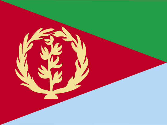 Eritrea ERIEastern Africa | 33,443.82 | 0.000 | 0.000 | 14,811.449 | 18,632.373 | 0.000 |
 Guyana GUYSouth America | 27,648.04 | 407.852 | 1,803.134 | 18,975.824 | 6,396.829 | 64.398 |
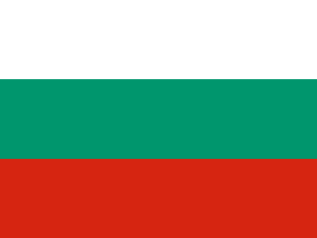 Bulgaria BGREastern Europe | 26,553.28 | 128.795 | 450.785 | 794.239 | 25,179.461 | 0.000 |
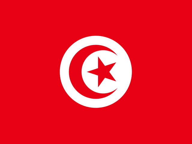 Tunisia TUNNorthern Africa | 25,544.38 | 1,266.486 | 729.840 | 16,399.922 | 6,697.351 | 450.783 |
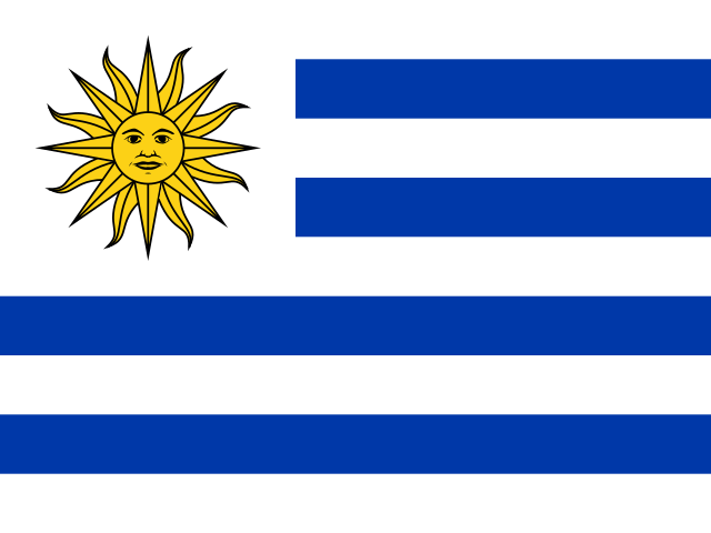 Uruguay URYSouth America | 25,093.61 | 3,477.471 | 8,715.145 | 8,114.101 | 4,679.561 | 107.330 |
 Burundi BDIEastern Africa | 24,621.35 | 64.398 | 20,542.835 | 1,030.361 | 2,983.756 | 0.000 |
 Montenegro MNESouthern Europe | 23,633.92 | 128.796 | 11,720.364 | 11,784.763 | 0.000 | 0.000 |
 Moldova MDAEastern Europe | 22,775.29 | 386.385 | 107.330 | 257.591 | 22,023.980 | 0.000 |
 Costa Rica CRICentral America | 21,594.66 | 1,159.156 | 6,461.227 | 5,087.410 | 8,886.869 | 0.000 |
 France FRAWestern Europe | 21,337.07 | 2,962.291 | 8,672.211 | 1,373.815 | 8,285.825 | 42.932 |
 Belize BLZCentral America | 21,315.61 | 6,203.636 | 4,164.381 | 10,604.138 | 42.932 | 300.522 |
 Albania ALBSouthern Europe | 18,589.44 | 1,395.283 | 6,439.762 | 9,702.572 | 772.771 | 279.056 |
 Egypt EGYNorthern Africa | 18,245.99 | 0.000 | 21.466 | 16,593.115 | 1,631.407 | 0.000 |
 Portugal PRTSouthern Europe | 15,992.07 | 407.852 | 4,636.630 | 9,165.925 | 1,781.668 | 0.000 |
 Serbia SRBSouthern Europe | 14,961.71 | 279.057 | 1,631.405 | 1,051.828 | 11,935.022 | 64.398 |
 Georgia GEOWestern Asia | 12,063.82 | 128.795 | 1,609.940 | 2,940.824 | 7,384.259 | 0.000 |
 Malaysia MYSSouth-eastern Asia | 12,042.36 | 2,747.634 | 2,146.585 | 515.182 | 5,838.716 | 794.238 |
 North Macedonia MKDSouthern Europe | 11,183.72 | 2,425.644 | 3,370.143 | 4,164.380 | 1,223.556 | 0.000 |
 Armenia ARMWestern Asia | 10,840.27 | 493.715 | 558.113 | 7,083.738 | 2,704.700 | 0.000 |
 Belarus BLREastern Europe | 9,359.12 | 558.113 | 1,609.943 | 3,456.003 | 3,735.061 | 0.000 |
 Bahamas BHSCaribbean | 9,080.06 | 3,241.345 | 5,044.477 | 601.045 | 0.000 | 193.194 |
 Afghanistan AFGSouthern Asia | 8,886.87 | 0.000 | 1,008.896 | 7,598.918 | 279.057 | 0.000 |
 Dominican Republic DOMCaribbean | 7,427.20 | 321.989 | 3,413.074 | 1,202.089 | 2,490.044 | 0.000 |
 Japan JPNEastern Asia | 7,341.33 | 923.032 | 1,287.952 | 85.863 | 5,001.547 | 42.932 |
 Liberia LBRWestern Africa | 7,083.74 | 3,219.881 | 3,541.869 | 107.329 | 214.659 | 0.000 |
 Panama PANCentral America | 7,019.34 | 64.398 | 2,039.256 | 2,253.915 | 2,661.769 | 0.000 |
 North Korea PRKEastern Asia | 6,117.77 | 85.863 | 42.932 | 407.852 | 5,302.069 | 279.057 |
 Saudi Arabia SAUWestern Asia | 5,988.98 | 0.000 | 21.466 | 4,593.695 | 1,373.815 | 0.000 |
 Somalia SOMEastern Africa | 5,666.99 | 0.000 | 0.000 | 4,894.218 | 772.771 | 0.000 |
 Cyprus CYPWestern Asia | 5,645.52 | 0.000 | 171.727 | 5,087.411 | 386.386 | 0.000 |
 New Caledonia NCLMelanesia | 5,130.34 | 21.466 | 4,615.161 | 386.386 | 21.466 | 85.863 |
 El Salvador SLVCentral America | 5,108.88 | 107.329 | 279.057 | 364.920 | 4,357.571 | 0.000 |
 Morocco MARNorthern Africa | 4,550.77 | 321.988 | 751.306 | 2,876.426 | 601.045 | 0.000 |
 Croatia HRVSouthern Europe | 4,486.37 | 0.000 | 643.977 | 3,670.663 | 171.728 | 0.000 |
 Sri Lanka LKASouthern Asia | 4,464.90 | 0.000 | 3,863.856 | 21.466 | 579.578 | 0.000 |
 Tajikistan TJKCentral Asia | 4,185.84 | 0.000 | 0.000 | 1,416.747 | 2,769.096 | 0.000 |
 Bhutan BTNSouthern Asia | 3,241.35 | 1,416.749 | 1,094.759 | 622.511 | 107.329 | 0.000 |
 Suriname SURSouth America | 3,198.42 | 64.398 | 85.864 | 493.714 | 2,554.439 | 0.000 |
 New Zealand NZLAustralia and New Zealand | 2,919.36 | 536.647 | 1,652.872 | 321.988 | 364.920 | 42.932 |
 Kyrgyzstan KGZCentral Asia | 2,661.77 | 0.000 | 0.000 | 858.635 | 1,803.133 | 0.000 |
 Israel ISRWestern Asia | 2,318.31 | 0.000 | 0.000 | 1,846.065 | 472.249 | 0.000 |
 Haiti HTICaribbean | 1,846.07 | 0.000 | 128.796 | 729.840 | 987.431 | 0.000 |
 Kosovo XKXSouthern Europe | 1,545.54 | 0.000 | 794.237 | 643.977 | 107.330 | 0.000 |
 Lebanon LBNWestern Asia | 1,266.49 | 107.329 | 0.000 | 1,073.295 | 85.864 | 0.000 |
 Finland FINNorthern Europe | 923.03 | 107.330 | 407.852 | 386.386 | 21.466 | 0.000 |
 Taiwan TWNEastern Asia | 880.10 | 0.000 | 21.466 | 0.000 | 858.635 | 0.000 |
 Palestine PSEWestern Asia | 751.31 | 0.000 | 0.000 | 42.932 | 708.374 | 0.000 |
 Fiji FJIMelanesia | 729.84 | 0.000 | 42.932 | 21.466 | 665.443 | 0.000 |
 Czechia CZEEastern Europe | 708.38 | 21.466 | 64.398 | 64.398 | 558.113 | 0.000 |
 Hong Kong HKGEastern Asia | 579.58 | 0.000 | 515.181 | 64.398 | 0.000 | 0.000 |
 Jamaica JAMCaribbean | 558.11 | 0.000 | 21.466 | 0.000 | 536.647 | 0.000 |
 Slovakia SVKEastern Europe | 343.46 | 21.466 | 0.000 | 0.000 | 321.989 | 0.000 |
 Timor-Leste TLSSouth-eastern Asia | 300.52 | 150.261 | 150.262 | 0.000 | 0.000 | 0.000 |
 Hungary HUNEastern Europe | 257.59 | 0.000 | 0.000 | 42.932 | 214.660 | 0.000 |
 Puerto Rico PRICaribbean | 214.66 | 0.000 | 193.194 | 21.466 | 0.000 | 0.000 |
 Trinidad and Tobago TTOCaribbean | 193.19 | 0.000 | 42.932 | 150.261 | 0.000 | 0.000 |
 Poland POLEastern Europe | 193.19 | 0.000 | 0.000 | 0.000 | 193.193 | 0.000 |
 Austria AUTWestern Europe | 128.80 | 128.796 | 0.000 | 0.000 | 0.000 | 0.000 |
 Latvia LVANorthern Europe | 128.80 | 0.000 | 42.932 | 21.466 | 64.398 | 0.000 |
 Lithuania LTUNorthern Europe | 128.80 | 42.932 | 0.000 | 21.466 | 64.398 | 0.000 |
 Jordan JORWestern Asia | 128.80 | 0.000 | 0.000 | 42.932 | 85.863 | 0.000 |
 Estonia ESTNorthern Europe | 85.86 | 0.000 | 42.932 | 21.466 | 21.466 | 0.000 |
 Yemen YEMWestern Asia | 85.86 | 0.000 | 0.000 | 85.864 | 0.000 | 0.000 |
 Germany DEUWestern Europe | 64.40 | 21.466 | 42.932 | 0.000 | 0.000 | 0.000 |
 Equatorial Guinea GNQMiddle Africa | 21.47 | 21.466 | 0.000 | 0.000 | 0.000 | 0.000 |
 American Samoa ASMPolynesia | 0.00 | 0.000 | 0.000 | 0.000 | 0.000 | 0.000 |
 Andorra ANDSouthern Europe | 0.00 | 0.000 | 0.000 | 0.000 | 0.000 | 0.000 |
 Antigua and Barbuda ATGCaribbean | 0.00 | 0.000 | 0.000 | 0.000 | 0.000 | 0.000 |
 Bahrain BHRWestern Asia | 0.00 | 0.000 | 0.000 | 0.000 | 0.000 | 0.000 |
 Barbados BRBCaribbean | 0.00 | 0.000 | 0.000 | 0.000 | 0.000 | 0.000 |
 Belgium BELWestern Europe | 0.00 | 0.000 | 0.000 | 0.000 | 0.000 | 0.000 |
 Bermuda BMUNorthern America | 0.00 | 0.000 | 0.000 | 0.000 | 0.000 | 0.000 |
 British Virgin Islands VGBCaribbean | 0.00 | 0.000 | 0.000 | 0.000 | 0.000 | 0.000 |
 Brunei BRNSouth-eastern Asia | 0.00 | 0.000 | 0.000 | 0.000 | 0.000 | 0.000 |
 Cabo Verde CPVWestern Africa | 0.00 | 0.000 | 0.000 | 0.000 | 0.000 | 0.000 |
 Cayman Islands CYMCaribbean | 0.00 | 0.000 | 0.000 | 0.000 | 0.000 | 0.000 |
 Comoros COMEastern Africa | 0.00 | 0.000 | 0.000 | 0.000 | 0.000 | 0.000 |
 Denmark DNKNorthern Europe | 0.00 | 0.000 | 0.000 | 0.000 | 0.000 | 0.000 |
 Djibouti DJIEastern Africa | 0.00 | 0.000 | 0.000 | 0.000 | 0.000 | 0.000 |
 Dominica DMACaribbean | 0.00 | 0.000 | 0.000 | 0.000 | 0.000 | 0.000 |
 Faroe Islands FRONorthern Europe | 0.00 | 0.000 | 0.000 | 0.000 | 0.000 | 0.000 |
 French Polynesia PYFPolynesia | 0.00 | 0.000 | 0.000 | 0.000 | 0.000 | 0.000 |
 Greenland GRLNorthern America | 0.00 | 0.000 | 0.000 | 0.000 | 0.000 | 0.000 |
 Grenada GRDCaribbean | 0.00 | 0.000 | 0.000 | 0.000 | 0.000 | 0.000 |
 Guam GUMMicronesia | 0.00 | 0.000 | 0.000 | 0.000 | 0.000 | 0.000 |
 Iceland ISLNorthern Europe | 0.00 | 0.000 | 0.000 | 0.000 | 0.000 | 0.000 |
 Ireland IRLNorthern Europe | 0.00 | 0.000 | 0.000 | 0.000 | 0.000 | 0.000 |
 Isle of Man IMNNorthern Europe | 0.00 | 0.000 | 0.000 | 0.000 | 0.000 | 0.000 |
 Kuwait KWTWestern Asia | 0.00 | 0.000 | 0.000 | 0.000 | 0.000 | 0.000 |
 Libya LBYNorthern Africa | 0.00 | 0.000 | 0.000 | 0.000 | 0.000 | 0.000 |
 Liechtenstein LIEWestern Europe | 0.00 | 0.000 | 0.000 | 0.000 | 0.000 | 0.000 |
 Luxembourg LUXWestern Europe | 0.00 | 0.000 | 0.000 | 0.000 | 0.000 | 0.000 |
 Macau MACEastern Asia | 0.00 | 0.000 | 0.000 | 0.000 | 0.000 | 0.000 |
 Malta MLTSouthern Europe | 0.00 | 0.000 | 0.000 | 0.000 | 0.000 | 0.000 |
 Mauritius MUSEastern Africa | 0.00 | 0.000 | 0.000 | 0.000 | 0.000 | 0.000 |
 Micronesia FSMMicronesia | 0.00 | 0.000 | 0.000 | 0.000 | 0.000 | 0.000 |
 Montserrat MSRCaribbean | 0.00 | 0.000 | 0.000 | 0.000 | 0.000 | 0.000 |
 Nauru NRUMicronesia | 0.00 | 0.000 | 0.000 | 0.000 | 0.000 | 0.000 |
 Netherlands NLDWestern Europe | 0.00 | 0.000 | 0.000 | 0.000 | 0.000 | 0.000 |
 Northern Mariana Islands MNPMicronesia | 0.00 | 0.000 | 0.000 | 0.000 | 0.000 | 0.000 |
 Norway NORNorthern Europe | 0.00 | 0.000 | 0.000 | 0.000 | 0.000 | 0.000 |
 Oman OMNWestern Asia | 0.00 | 0.000 | 0.000 | 0.000 | 0.000 | 0.000 |
 Palau PLWMicronesia | 0.00 | 0.000 | 0.000 | 0.000 | 0.000 | 0.000 |
 Qatar QATWestern Asia | 0.00 | 0.000 | 0.000 | 0.000 | 0.000 | 0.000 |
 Saint Kitts and Nevis KNACaribbean | 0.00 | 0.000 | 0.000 | 0.000 | 0.000 | 0.000 |
 Saint Lucia LCACaribbean | 0.00 | 0.000 | 0.000 | 0.000 | 0.000 | 0.000 |
 Saint Vincent and the Grenadines VCTCaribbean | 0.00 | 0.000 | 0.000 | 0.000 | 0.000 | 0.000 |
 Samoa WSMPolynesia | 0.00 | 0.000 | 0.000 | 0.000 | 0.000 | 0.000 |
 San Marino SMRSouthern Europe | 0.00 | 0.000 | 0.000 | 0.000 | 0.000 | 0.000 |
 São Tomé and Príncipe STPMiddle Africa | 0.00 | 0.000 | 0.000 | 0.000 | 0.000 | 0.000 |
 Seychelles SYCEastern Africa | 0.00 | 0.000 | 0.000 | 0.000 | 0.000 | 0.000 |
 Singapore SGPSouth-eastern Asia | 0.00 | 0.000 | 0.000 | 0.000 | 0.000 | 0.000 |
 Slovenia SVNSouthern Europe | 0.00 | 0.000 | 0.000 | 0.000 | 0.000 | 0.000 |
 Solomon Islands SLBMelanesia | 0.00 | 0.000 | 0.000 | 0.000 | 0.000 | 0.000 |
 South Korea KOREastern Asia | 0.00 | 0.000 | 0.000 | 0.000 | 0.000 | 0.000 |
 Sweden SWENorthern Europe | 0.00 | 0.000 | 0.000 | 0.000 | 0.000 | 0.000 |
 Switzerland CHEWestern Europe | 0.00 | 0.000 | 0.000 | 0.000 | 0.000 | 0.000 |
 Tonga TONPolynesia | 0.00 | 0.000 | 0.000 | 0.000 | 0.000 | 0.000 |
 Turks and Caicos Islands TCACaribbean | 0.00 | 0.000 | 0.000 | 0.000 | 0.000 | 0.000 |
 Tuvalu TUVPolynesia | 0.00 | 0.000 | 0.000 | 0.000 | 0.000 | 0.000 |
 United Arab Emirates AREWestern Asia | 0.00 | 0.000 | 0.000 | 0.000 | 0.000 | 0.000 |
 United Kingdom GBRNorthern Europe | 0.00 | 0.000 | 0.000 | 0.000 | 0.000 | 0.000 |
 United States Virgin Islands VIRCaribbean | 0.00 | 0.000 | 0.000 | 0.000 | 0.000 | 0.000 |
 Vanuatu VUTMelanesia | 0.00 | 0.000 | 0.000 | 0.000 | 0.000 | 0.000 |
02In 2021
At either end
The 5 countries at each end of the headline, then the highest and lowest on each other measure.
Highest
- Angola34,489,337.85
- DR Congo33,362,272.50
- South Sudan28,143,426.41
- Australia26,610,248.29
- Zambia20,345,692.52
Lowest
- Samoashared0.00
- Vanuatushared0.00
- United States Virgin Islandsshared0.00
- British Virgin Islandsshared0.00
- Saint Vincent and the Grenadinesshared0.00
Neither end is better. The values describe a shape, not a score. The middle country reads 9,359.12. “Shared” marks a value another country also holds.
Each measure’s ends
Burned forest (hectares)
Highest
DR Congo4,382,085.093Lowest96 share it
Middle country: 42.932
Burned savanna (hectares)
Highest
DR Congo27,573,271.519Lowest82 share it
Middle country: 450.785
Burned shrubland and grassland (hectares)
Highest
Australia22,986,359.107Lowest67 share it
Middle country: 2,253.915
Burned cropland (hectares)
Highest
India4,133,725.004Lowest70 share it
Middle country: 1,116.225
Other burned land (hectares)
Highest
Brazil163,054.731Lowest122 share it
Middle country: 0.000
032020 → 2021
Since 2020
- +0 / −0countries joined / left
- 160values changed, of 209 in both
- 63 · 97rose · fell
- 49unchanged
Rose most
- Australia16,915,876.24 → 26,610,248.29+9,694,372.05
- Botswana3,215,028.82 → 10,595,294.53+7,380,265.71
- Canada263,772.58 → 3,629,921.10+3,366,148.51
- India4,528,847.26 → 6,785,081.62+2,256,234.37
- South Africa3,035,574.18 → 5,183,599.12+2,148,024.94
Fell most
- Brazil21,503,260.90 → 15,723,619.07−5,779,641.83
- Argentina5,896,824.05 → 2,455,652.31−3,441,171.74
- Ghana6,854,394.90 → 4,491,346.36−2,363,048.54
- Venezuela4,604,707.61 → 2,358,841.25−2,245,866.36
- South Sudan30,343,012.37 → 28,143,426.41−2,199,585.96
04Caveats
Read before you use
One year of the 2026 release
Every year in this series comes from GWIS’s 2026 release, recalculated on one method, so a change from one year to the next is not a revision. It can differ from what was first published for 2021.
148 distinct values among 209
Values are stored exactly as published, to 14 decimals. 59 countries share 0.00. Countries sharing a value share a position too.
Nothing missing
Every one of the 209 countries has every column.
05The files
Download and cite
- .csv
For a spreadsheet or code
209 rows · 16 KB · UTF-8, opens in Excel
Opens with 11 lines of source notes; the table starts on row 13.
Download burned-area-2021-nations-inquiry.csv - ↗
The publisher’s original
GWIS’s own file, on its own site.
banf
What this site changed: Reshaped to one row per country, with its ISO code; no value recalculated, rescaled or rounded. In full
Licence: CC BY 4.0 · what it allows, in plain words
Cite this edition
European Commission Joint Research Centre — Global Wildfire Information System (GWIS) (2021). Burned Area, 2021 [data set], describing 2021. As held by Nations Inquiry, https://nationsinquiry.com/datasets/burned-area/2021
0624 held
Other years
‹ The year before
Burned Area, 2020209 countries
The year after ›
Burned Area, 2022209 countries
All of them
Burned Area: every year24 held, with the data dictionary, coverage and licence.
How it has moved, charted by country