
Photo: P. Miller, (Pdmiller) · CC0 · via Wikimedia Commons, shown in greyscale
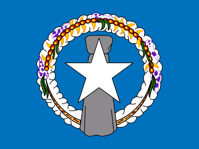
Northern Mariana Islands
Northern Mariana Islands places highest on PM2.5 Air Pollution Exposure (top 2% worldwide) and lowest on Liner Shipping Connectivity Index (bottom 11%).
Share
Northern Mariana Islands in the Nations Inquiry Country Index
Northern Mariana Islands appears in 49 of the statistics tracked here, but is not placed in the Country Index: the index needs a standing on three quarters of its topics, and Northern Mariana Islands is measured on too few of them. Every published reading below is unaffected.
At a glance
Population
45,143
people
since 1950
Land area
457
km²
since 1991
Life expectancy
78.81
years at birth
since 1950
The newest published figure for each, the year it describes and who published it, with a line showing how it has moved.
01The country
About Northern Mariana Islands
The Northern Mariana Islands are a commonwealth in political union with the United States, governing themselves under their own constitution. They trace a volcanic arc across the western Pacific: Saipan, Tinian and Rota in the south are raised limestone with beaches and cliffs, while Pagan, Agrihan and Anatahan in the north are volcanoes, some active within living memory. East of the chain the sea floor drops into the Mariana Trench. Typhoons sweep through in the wet season.
Seafarers from island South-East Asia reached the Marianas by about 1500 BC; their descendants, the Chamorro, set their houses on latte, paired stone columns topped with rounded capstones. Magellan arrived in 1521; Spain colonised the islands from 1668, naming them for Queen Mariana, and forcibly moved the northern Chamorro to Guam. Germany bought the islands in 1899 and Japan took them in 1914. Bombers that dropped atomic bombs on Hiroshima and Nagasaki in August 1945 flew from Tinian, and the commonwealth was formed in 1978.
Chamorro and Carolinian families keep their own customs, and each village keeps its patron saint’s feast with processions, Mass and long tables of food. Achote seeds turn the festive rice red, and kelaguen, chopped meat or seafood soured with lemon, coconut and hot pepper, is never missing. Visitors from East Asia, flying in for beaches and diving at the Grotto, and federal spending sustain the economy, while garment factories that dominated Saipan in the 1990s closed in the 2000s.
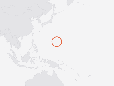
Key facts about Northern Mariana Islands
- Capital
- Saipan
- Official languages
- Carolinian, Chamorro, English
- Currency
- United States dollar (USD)
- ISO code
- MNP · MP
- Domain · dialling
- .mp · +1670
As Wikidata records them. Official languages are the least consistent — some countries list only a national language, others every regional one. Sources and licences.
02Country Index 2026
Where it stands, topic by topic
Strongest first. Each position is Northern Mariana Islands’s place among the countries with a standing on that topic, built from a few key statistics chosen to measure different things.
68thof 177
From 2 of 4 key statistics
No standing — Northern Mariana Islands holds too few of this subject’s key statistics to be placed on it.
No standing — Northern Mariana Islands holds too few of this subject’s key statistics to be placed on it.
No standing — Northern Mariana Islands holds too few of this subject’s key statistics to be placed on it.
No standing — Northern Mariana Islands holds too few of this subject’s key statistics to be placed on it.
No standing — Northern Mariana Islands holds too few of this subject’s key statistics to be placed on it.
No standing — Northern Mariana Islands holds too few of this subject’s key statistics to be placed on it.
No standing — Northern Mariana Islands holds too few of this subject’s key statistics to be placed on it.
No standing — Northern Mariana Islands holds too few of this subject’s key statistics to be placed on it.
No standing — Northern Mariana Islands holds too few of this subject’s key statistics to be placed on it.
No standing — Northern Mariana Islands holds too few of this subject’s key statistics to be placed on it.
No standing — Northern Mariana Islands holds too few of this subject’s key statistics to be placed on it.
No standing — Northern Mariana Islands holds too few of this subject’s key statistics to be placed on it.
No standing — Northern Mariana Islands holds too few of this subject’s key statistics to be placed on it.
No standing — Northern Mariana Islands holds too few of this subject’s key statistics to be placed on it.
No standing — Northern Mariana Islands holds too few of this subject’s key statistics to be placed on it.
Each standing is built from a few key statistics chosen to measure different things. Select a subject for Northern Mariana Islands’s readings on it, or see every statistic held for Northern Mariana Islands in the table further down this page.
03Highs and lows
Where Northern Mariana Islands stands out
The two ends of its own record: every statistic on which Northern Mariana Islands sits within ten places of the best or worst in the world, plus its strongest and weakest readings overall. Each is turned into a percentile — its place among every country measured — which is what lets a hunger score and a press-freedom rank be compared at all.
Where Northern Mariana Islands does best5
In the top third of all countries measured. 2 are within ten places of the best in the world, in a field of at least 50 countries — marked with that place.
- 5th
Position · derived 152nd of 156 · 1 = worst · 1.2 · 2024
world median 4.4 (better)
- 5th
Position · derived 216th of 220 · 1 = worst · 3.1 · 2023
world median 14.45 (better)
Position · derived 166th of 222 · 1 = worst · 75.54 · 2023
world median 133.7 (better)
- Life Expectancy at Birthtop 26%
Position · derived 59th of 222 · 78.81 · 2023
world median 74.63 (better)
Where Northern Mariana Islands struggles most3
Nothing falls into the world's bottom third — these are Northern Mariana Islands's weakest areas even so.
- Liner Shipping Connectivity Indexbottom 11%
Rank 154th of 175 · 15.14 · 2026
world median 56.21 (worse) · ▼ 14 pts since 2016
- Municipal Solid Waste Generationbottom 17%
Position · derived 35th of 201 · 1 = worst · 1.727 · 2026
world median 0.966 (worse)
Position · derived 114th of 196 · 64.5 · 2023
world median 71.25 (worse)
A band is a place among the countries each publisher scores, so Northern Mariana Islands can move because other countries moved. See the Country Index for the full method.
04In context
Northern Mariana Islands and its neighbours
A position reads best beside the countries around it. Every position below is a place in the world ranking, not within the region.
Shares a land border with
Northern Mariana Islands has no land border with another country.
Across Micronesia
Every country in the sub-region, by its position in the world.
- 109
 Kiribati
- —
 Guamnot placed
- —
 Marshall Islandsnot placed
- —
 Micronesianot placed
- —
 Naurunot placed
- —Northern Mariana Islandsnot placed
- —
 Palaunot placed
05The evidence
Every statistic we hold for Northern Mariana Islands
Grouped by topic. Each row gives the newest edition’s rank or position, the published value and the year the numbers describe. Select a statistic for this country’s row beside every other country, the world median and every edition.
Economy & Innovation5
- Export Concentration IndexUNCTAD · Export concentration index (0–1, normalised Herfindahl–Hirschman)top 26%0.4552025
- Liner Shipping Connectivity IndexUNCTAD · LSCI (index, average Q1 2023 = 100)154th of 175rank15.142026
- Merchant Fleet by Country of OwnershipUNCTAD · Merchant fleet owned (thousand dead-weight tons)bottom 13%2.6792026
- Scholarly ArticlesOurResearch · Articles with at least one author at an institution in the country (full counting)bottom 7%172025
- Terms of Trade IndexUNCTAD · Terms of trade index (2015 = 100)top 32%113.362025
Health & Wellbeing9
- Adolescent Birth Rate (Ages 15–19)UN DESA Population Division · Live births per 1,000 women aged 15–19118th of 222position · derived · 1 = worst26.152023
- Adult Mortality (Probability of Dying Between 15 and 60)UN DESA Population Division · Deaths before age 60 per 1,000 people alive at 15, at that year's death rates166th of 222position · derived · 1 = worst75.542023
- Contraceptive Prevalence (Any Method)UN DESA Population Division · Share of all women aged 15–49 using any contraceptive method (%)bottom 21%26.82023
- Days Above 35°CECMWF · Days a year with a maximum temperature above 35°C, averaged over the country’s landtop 16%02025
- Demand for Family Planning Satisfied by Modern MethodsUN DESA Population Division · Share of women aged 15–49 wanting to avoid pregnancy who use a modern method (%)114th of 196position · derived64.52023
- Life Expectancy at Age 65UN DESA Population Division · Further years a 65-year-old would live at current death rates73rd of 222position · derived17.842023
- Life Expectancy at BirthUN DESA Population Division · Years a newborn would live at current death rates59th of 222position · derived78.812023
- Modern Contraceptive PrevalenceUN DESA Population Division · Share of all women aged 15–49 using a modern contraceptive method (%)bottom 26%23.92023
- PM2.5 Air Pollution ExposureAtmospheric Composition Analysis Group, Washington University in St. Louis · Population-weighted PM2.5 concentration (µg/m³)216th of 220position · derived · 1 = worst3.12023
Development & Human Capital2
- Access to ElectricityWorld Bank Group · Population with electricity access (%)top 28%1002024
- Access to Electricity, RuralWorld Bank Group · Rural population with electricity access (%)top 29%1002024
Environment & Sustainability9
- Agricultural LandFAO · Agricultural land (% of land area)205th of 209position · derived1.1742023
- Arable Land per PersonFAO · Arable land (hectares per person)200th of 206position · derived0.0022023
- Burned AreaGWIS · Burned area (hectares)bottom 12%02025
- Fisheries and Aquaculture ProductionFAO · Fish, crustaceans, molluscs and other aquatic animals caught or farmed, tonnes (live weight)bottom 5%72.622024
- Forest AreaFAO · Forest area (% of land area)42nd of 210position · derived52.962023
- Mangrove AreaGlobal Mangrove Watch (Aberystwyth University, JAXA, soloEO, Wetlands International, The Nature Conservancy) · Mangrove forest area (hectares)bottom 3%3.2072025
- Methane EmissionsEDGAR · Methane emissions (gigagrams of CH₄)bottom 2%0.1692025
- Municipal Solid Waste GenerationWorld Bank Group · Municipal solid waste generated (kg per person per day)35th of 201position · derived · 1 = worst1.7272026
- Population Living Below 5 m ElevationCenter for International Earth Science Information Network (CIESIN), Columbia University · Population living below 5 m elevation (% of total population)top 31%6.282015
Gender & Equality2
- Mean Age at First Marriage, WomenUN DESA Population Division · Singulate mean age at marriage, women (years)top 27%28.12019
- Sex Ratio at BirthUN DESA Population Division · Male births per 100 female birthstop 1%115.12023
Mobility & Trade5
- Container Import Dwell TimeWorld Bank Group · Median days a full import container waits in port152nd of 156position · derived · 1 = worst1.22024
- EmigrantsUN DESA Population Division · Migrants from the country living abroad, mid-year (people)bottom 9%2,7792024
- International MigrantsUN DESA Population Division · International migrants living in the country, mid-year (people)bottom 16%22,0002024
- Net Migration RateUN DESA Population Division · Net migrants per 1,000 populationbottom 2%-29.262023
Energy2
- Natural Gas ProductionEIA · Dry natural gas produced (billion cubic metres)bottom 27%02024
- Photovoltaic Power Potential (PVOUT)World Bank Group (ESMAP), data by Solargis · Practical solar power potential (kWh per kWp per day, long-term average)top 27%4.6552020
Digital & Technology2
- GitHub DevelopersGitHub · Developer accounts located in the economy (as of quarter end)bottom 9%1,3712026
- GitHub RepositoriesGitHub · Public repositories located in the economy (as of quarter end)bottom 12%2,6422026
People & Population13
- Crude Birth RateUN DESA Population Division · Births per 1,000 populationbottom 47%12.922023
- Crude Death RateUN DESA Population Division · Deaths per 1,000 populationbottom 7%4.7042023
- Mean Age at ChildbearingUN DESA Population Division · Mean age of mothers at the birth of their children (years)bottom 48%29.052023
- Median Age of the PopulationUN DESA Population Division · Median age (years)top 35%36.142023
- Population Aged 65 and OverUN DESA Population Division · Share of the total population aged 65 and over (%)top 48%8.7332023
- Population DensityUN DESA Population Division · People per square kilometre of landtop 49%98.782023
- Population Growth RateUN DESA Population Division · Population growth (% per year)bottom 1%-2.1052023
- Population Living in Cities (Degree of Urbanisation)UN DESA Population Division · Share of the population living in cities as the Degree of Urbanisation defines them (%)bottom 8%02025
- Population Under Age 15UN DESA Population Division · Share of the total population aged 0–14 (%)bottom 50%22.592023
- Sex Ratio of the Total PopulationUN DESA Population Division · Males per 100 femalestop 5%111.492023
- Total Dependency RatioUN DESA Population Division · People aged 0–14 and 65+ per 100 people aged 15–64bottom 20%45.62023
- Total Fertility RateUN DESA Population Division · Live births per womantop 38%2.3492023
06Method
Sources and how to read them
How to read this page
- The scores and ranks belong to their publishers. Nothing is adjusted, rescaled or re-ranked; each is reproduced from the edition named beside it. Where a row says position · derived, the publisher ranks nobody on that measure and the position is ours, made by ordering the published score.
- Each statistic shows its newest edition, which is not always the edition the Country Index uses: the index pins every source to one data year so its average compares like with like.
How a standing is built from percentiles, why Northern Mariana Islands can move because other countries moved, and why publishers measure between 120 and 215 countries each are set out in full in how a standing is made and what a standing cannot tell you.
Sources
- Statistics: 14 publishers, each named beside its numbers, with every edition and licence on the datasets pages.
- Capital, languages, currency, codes: Wikidata, public domain (CC0).
- Map and land borders: Natural Earth, public domain. Borders are de facto — where administration actually changes — not claimed.
Photographs
The photograph of Northern Mariana Islands on this page comes from Wikimedia Commons and is shown in greyscale. The photographer and the licence are named beside each one.
Cite this page
Nations Inquiry (2026). Northern Mariana Islands: country statistics, rankings and trends. https://nationsinquiry.com/countries/northern-mariana-islands